
The maps of the Pacific – James Cook
Context
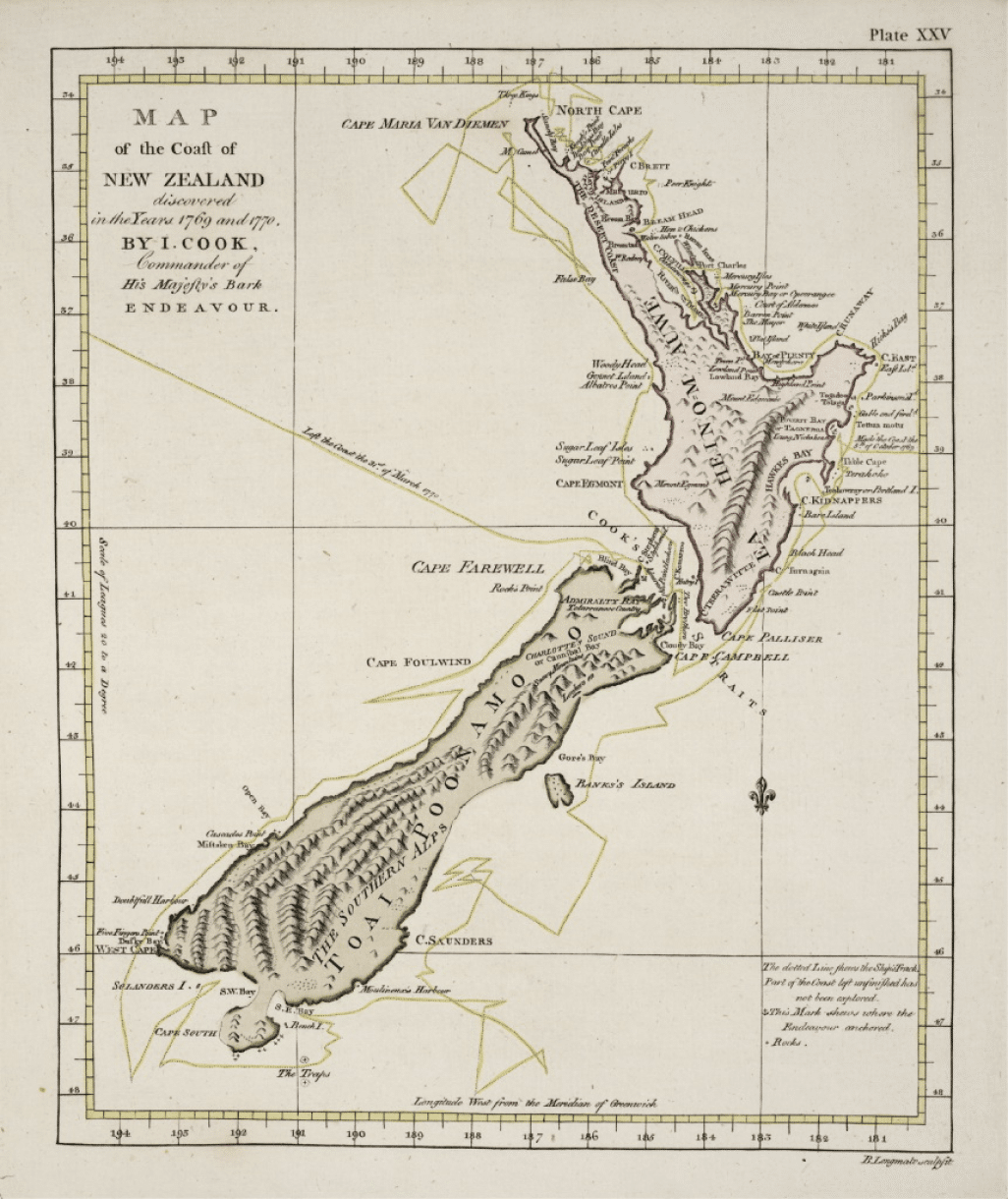
In the 18th century, Captain Cook was sailing in the era of the great maritime explorations (notably those of Bougainville, Vancouver, and the Count of Lapérouse). He himself led three major expeditions to the Pacific. The navigator discovered and documented an extraordinary number of coasts, islands, atolls, and archipelagos (at least from a European point of view). He was also the first to reach the East coast of Australia, the Cook Islands, and New Zealand. Through his meticulous documentation of his discoveries, he profoundly transformed our understanding of the Pacific.
A discovery drawn out
James Cook created his drawings in real-time aboard the HMS Endeavour, seated at his work table and rocked by the tumultuous ocean waves – all for the sake of greater precision. He began by drawing quick outlines, which he then refined by adding precise details of these vast territories still invisible to the West.
The consistency of the symbols used is remarkable. James Cook has, no more and no less, crystallised a visual grammar: reefs, obstacles, currents, contours and unknown territories are all meticulously represented in the same way.